
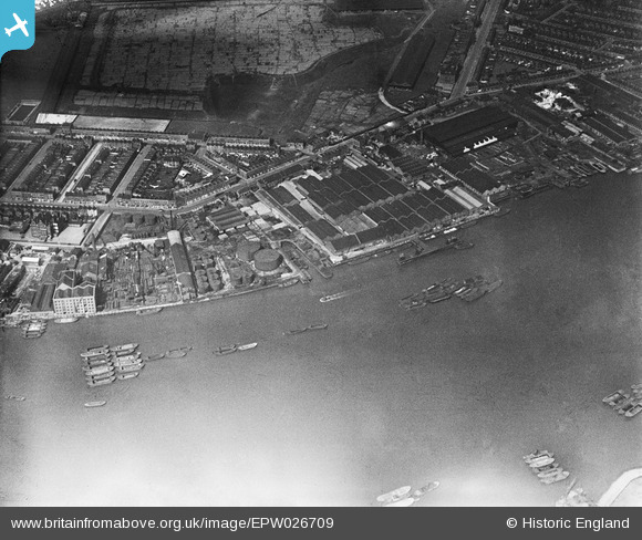
EPW026709 ENGLAND (1929). Millwall Wharf and environs, Cubitt Town, 1929
© Copyright OpenStreetMap contributors and licensed by the OpenStreetMap Foundation. 2026. Cartography is licensed as CC BY-SA.
Nearby Images (18)
EPW026709

EPW026714

EPW026717

EPW026710

EPW026715

EPW026713

EPW026711

EPW026716

EPW026712

EPW026718

EPW034939

EPW034937

EPW034944

EPW034942

EPW034936

EPW034940

EPW034941

EPW034943

Details
| Title | [EPW026709] Millwall Wharf and environs, Cubitt Town, 1929 |
| Reference | EPW026709 |
| Date | 16-May-1929 |
| Link | |
| Place name | CUBITT TOWN |
| Parish | |
| District | |
| Country | ENGLAND |
| Easting / Northing | 538664, 178986 |
| Longitude / Latitude | -0.0023802662676828, 51.492307606393 |
| National Grid Reference | TQ387790 |
Pins
Be the first to add a comment to this image!
User Comment Contributions
There's The London PH sitting there on the 'V'corner of Manchester Rd and Glengall Grove |

PeterJames |
Sunday 21st of October 2012 12:02:14 AM |