
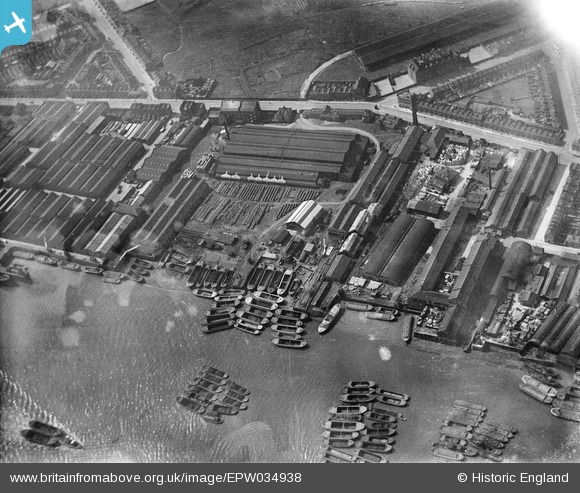
EPW034938 ENGLAND (1931). The Morton's Jam Factory and environs, Cubitt Town, 1931
© Copyright OpenStreetMap contributors and licensed by the OpenStreetMap Foundation. 2026. Cartography is licensed as CC BY-SA.
Nearby Images (17)
EPW034938

EPW034943

EPW034940

EPW034941

EPW034936

EPW034937

EPW034944

EPW034939

EPW034942

EPW026718

EPW026712

EPW026716

EPW026713

EPW026715

EPW026711

EPW026710

EPW026717

Details
| Title | [EPW034938] The Morton's Jam Factory and environs, Cubitt Town, 1931 |
| Reference | EPW034938 |
| Date | 10-April-1931 |
| Link | |
| Place name | CUBITT TOWN |
| Parish | |
| District | |
| Country | ENGLAND |
| Easting / Northing | 538489, 179251 |
| Longitude / Latitude | -0.0047956984553738, 51.494732076194 |
| National Grid Reference | TQ385793 |
Pins

PeterJames |
Thursday 3rd of January 2013 08:46:41 PM | |
|
PeterJames |
Thursday 3rd of January 2013 08:45:33 PM | |
|
PeterJames |
Thursday 3rd of January 2013 08:44:27 PM |