
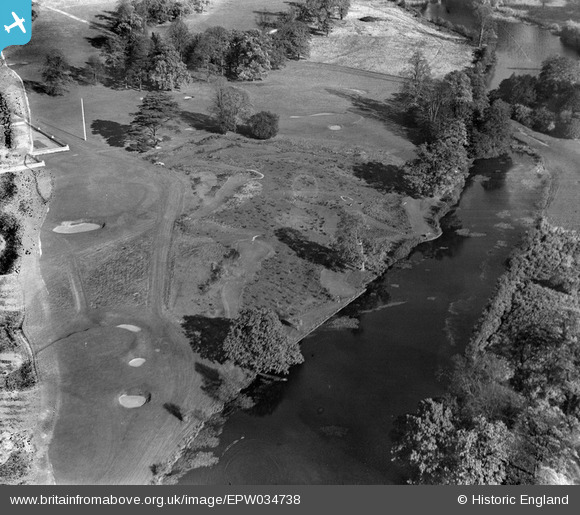
EPW034738 ENGLAND (1930). Stoke Poges Golf Course and Putting Green, Stoke Poges, 1930. This image has been produced from a damaged negative.
© Copyright OpenStreetMap contributors and licensed by the OpenStreetMap Foundation. 2026. Cartography is licensed as CC BY-SA.
Nearby Images (13)
EPW034738

EPW034736

EPW034735

EPW034737

EPW034746

EPW000033

EPW015611

EPW000032

EPW034745

EPW034744

EPW015612

EAW022119

EPW034740

Details
| Title | [EPW034738] Stoke Poges Golf Course and Putting Green, Stoke Poges, 1930. This image has been produced from a damaged negative. |
| Reference | EPW034738 |
| Date | 29-October-1930 |
| Link | |
| Place name | STOKE POGES |
| Parish | STOKE POGES |
| District | |
| Country | ENGLAND |
| Easting / Northing | 497090, 182502 |
| Longitude / Latitude | -0.60010124539706, 51.532586414119 |
| National Grid Reference | SU971825 |
Pins
Be the first to add a comment to this image!