
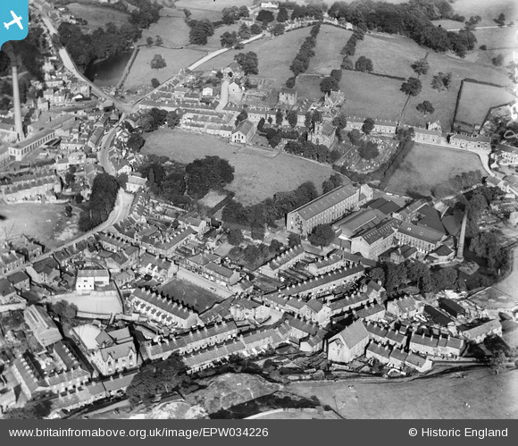
EPW034226 ENGLAND (1930). The High Street and town centre, Bollington, 1930
© Copyright OpenStreetMap contributors and licensed by the OpenStreetMap Foundation. 2026. Cartography is licensed as CC BY-SA.
Nearby Images (14)
EPW034226

EAW049655

EAW049650

EAW049649

EAW049648

EAW049652

EAW049653

EAW049656

EAW049651

EAW049654

EPW034221

EAW014492

EAW014493

EAW014494

Details
| Title | [EPW034226] The High Street and town centre, Bollington, 1930 |
| Reference | EPW034226 |
| Date | July-1930 |
| Link | |
| Place name | BOLLINGTON |
| Parish | BOLLINGTON |
| District | |
| Country | ENGLAND |
| Easting / Northing | 393768, 377784 |
| Longitude / Latitude | -2.0935132332246, 53.296701973121 |
| National Grid Reference | SJ938778 |
Pins

HalW108 |
Sunday 7th of February 2016 04:53:22 PM | |
|
HalW108 |
Sunday 7th of February 2016 04:47:59 PM | |
|
HalW108 |
Sunday 7th of February 2016 04:45:10 PM | |
|
jonnyhud |
Tuesday 12th of November 2013 12:19:59 PM | |
|
jonnyhud |
Tuesday 12th of November 2013 12:18:49 PM |