
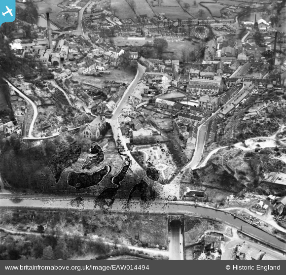
EAW014494 ENGLAND (1948). Palmerston Street, Water Street and environs, Bollington, 1948. This image has been produced from a damaged negative.
© Copyright OpenStreetMap contributors and licensed by the OpenStreetMap Foundation. 2026. Cartography is licensed as CC BY-SA.
Nearby Images (10)
EAW014494

EAW014493

EPW034221

EPW034226

EPW034225

EPW016765

EAW049649

EAW049655

EAW049652

EAW049656

Details
| Title | [EAW014494] Palmerston Street, Water Street and environs, Bollington, 1948. This image has been produced from a damaged negative. |
| Reference | EAW014494 |
| Date | 14-April-1948 |
| Link | |
| Place name | BOLLINGTON |
| Parish | BOLLINGTON |
| District | |
| Country | ENGLAND |
| Easting / Northing | 393544, 377905 |
| Longitude / Latitude | -2.096876883876, 53.297787051095 |
| National Grid Reference | SJ935779 |
Pins
Be the first to add a comment to this image!