
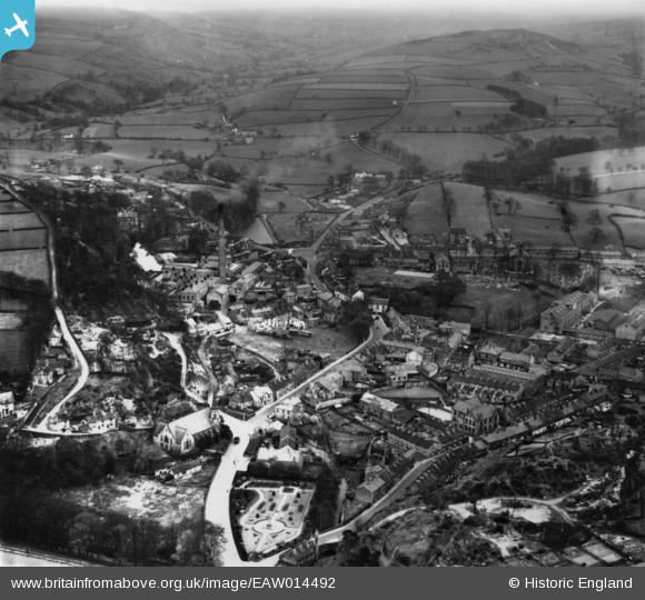
EAW014492 ENGLAND (1948). The town, Bollington, 1948. This image has been produced from a print.
© Copyright OpenStreetMap contributors and licensed by the OpenStreetMap Foundation. 2026. Cartography is licensed as CC BY-SA.
Nearby Images (13)
EAW014492

EPW034226

EAW014493

EAW049648

EAW049650

EAW049655

EPW034221

EAW049653

EAW049649

EAW049652

EAW049651

EAW049654

EAW049656

Details
| Title | [EAW014492] The town, Bollington, 1948. This image has been produced from a print. |
| Reference | EAW014492 |
| Date | 14-April-1948 |
| Link | |
| Place name | BOLLINGTON |
| Parish | BOLLINGTON |
| District | |
| Country | ENGLAND |
| Easting / Northing | 393824, 377922 |
| Longitude / Latitude | -2.0926756211806, 53.297943215209 |
| National Grid Reference | SJ938779 |
Pins
Be the first to add a comment to this image!