
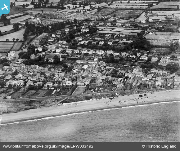
EPW033492 ENGLAND (1930). St Peter's Church and the town, Budleigh Salterton, 1930
© Copyright OpenStreetMap contributors and licensed by the OpenStreetMap Foundation. 2026. Cartography is licensed as CC BY-SA.
Nearby Images (11)
EPW033492

EPW023995

EPW023992

EPW033491

EPW033490

EPW023994

EPW033486

EPW033485

EPW033488

EPW033487

EPW033489

Details
| Title | [EPW033492] St Peter's Church and the town, Budleigh Salterton, 1930 |
| Reference | EPW033492 |
| Date | July-1930 |
| Link | |
| Place name | BUDLEIGH SALTERTON |
| Parish | BUDLEIGH SALTERTON |
| District | |
| Country | ENGLAND |
| Easting / Northing | 306370, 81934 |
| Longitude / Latitude | -3.3239589715711, 50.628994091314 |
| National Grid Reference | SY064819 |
Pins
Allen T |
Thursday 4th of September 2014 12:16:57 PM |