
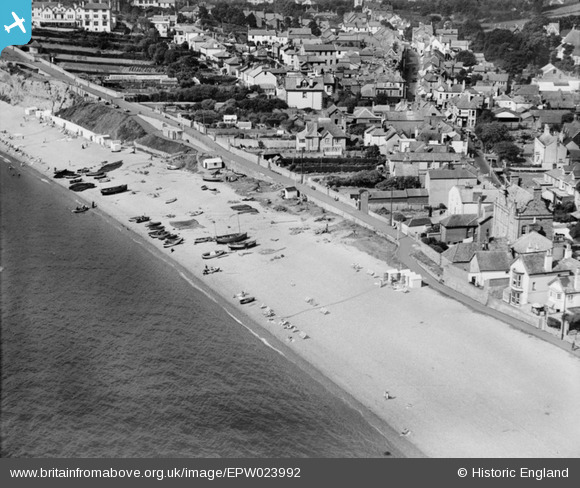
EPW023992 ENGLAND (1928). Cliff Path and environs, Budleigh Salterton, 1928
© Copyright OpenStreetMap contributors and licensed by the OpenStreetMap Foundation. 2026. Cartography is licensed as CC BY-SA.
Nearby Images (4)
EPW023992

EPW023995

EPW033491

EPW033492

Details
| Title | [EPW023992] Cliff Path and environs, Budleigh Salterton, 1928 |
| Reference | EPW023992 |
| Date | September-1928 |
| Link | |
| Place name | BUDLEIGH SALTERTON |
| Parish | BUDLEIGH SALTERTON |
| District | |
| Country | ENGLAND |
| Easting / Northing | 306521, 81815 |
| Longitude / Latitude | -3.3217943819454, 50.627948346158 |
| National Grid Reference | SY065818 |
Pins
Be the first to add a comment to this image!