
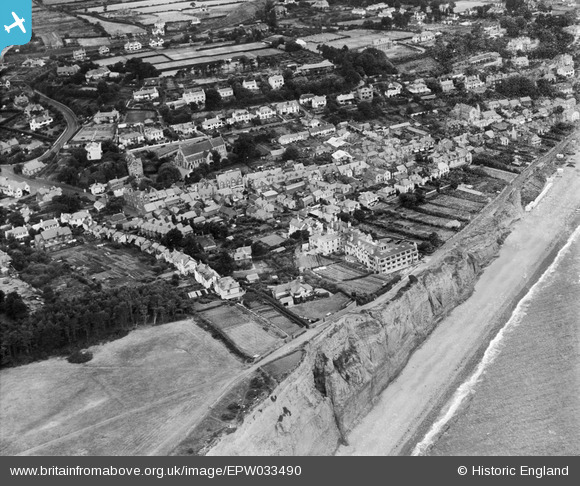
EPW033490 ENGLAND (1930). The town, Budleigh Salterton, 1930
© Copyright OpenStreetMap contributors and licensed by the OpenStreetMap Foundation. 2026. Cartography is licensed as CC BY-SA.
Nearby Images (9)
EPW033490

EPW033486

EPW033489

EPW033485

EPW023994

EPW033488

EPW033487

EPW023995

EPW033492

Details
| Title | [EPW033490] The town, Budleigh Salterton, 1930 |
| Reference | EPW033490 |
| Date | July-1930 |
| Link | |
| Place name | BUDLEIGH SALTERTON |
| Parish | BUDLEIGH SALTERTON |
| District | |
| Country | ENGLAND |
| Easting / Northing | 306185, 81821 |
| Longitude / Latitude | -3.3265455903177, 50.627948310068 |
| National Grid Reference | SY062818 |
Pins
Be the first to add a comment to this image!