
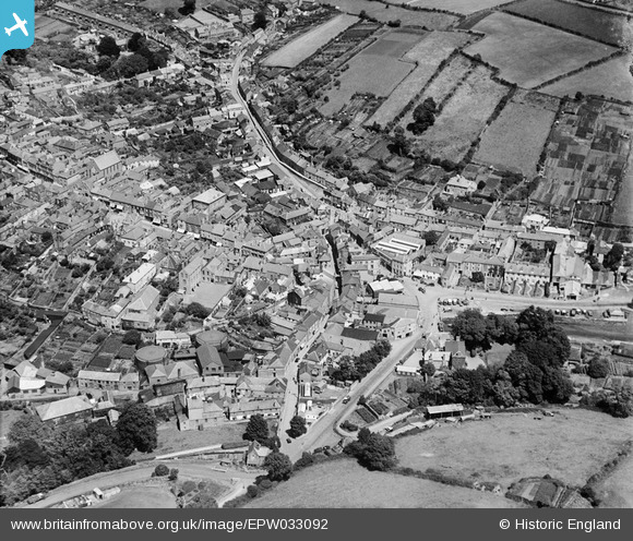
EPW033092 ENGLAND (1930). The town centre, Kingsbridge, 1930
© Copyright OpenStreetMap contributors and licensed by the OpenStreetMap Foundation. 2025. Cartography is licensed as CC BY-SA.
Nearby Images (8)
EPW033092

EPW023751

EPW023758

EPW033091

EPW033093

EPW033144

EPW023757

EPW023749

Details
| Title | [EPW033092] The town centre, Kingsbridge, 1930 |
| Reference | EPW033092 |
| Date | July-1930 |
| Link | |
| Place name | KINGSBRIDGE |
| Parish | KINGSBRIDGE |
| District | |
| Country | ENGLAND |
| Easting / Northing | 273493, 44178 |
| Longitude / Latitude | -3.7758844678791, 50.283368512018 |
| National Grid Reference | SX735442 |
