
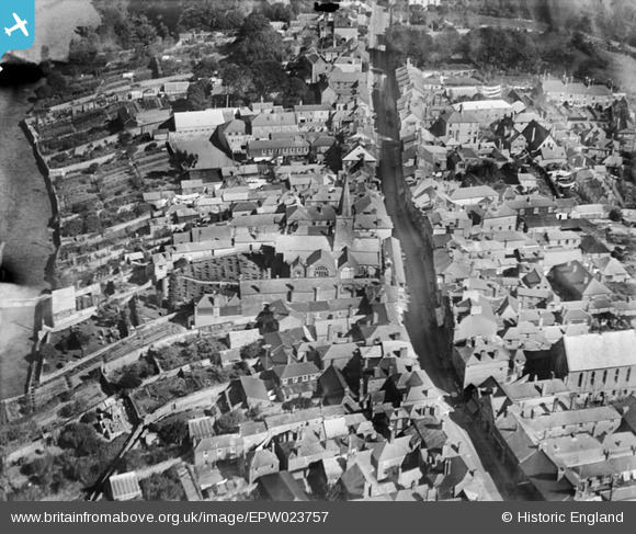
EPW023757 ENGLAND (1928). St Edmund's Church and Fore Street, Kingsbridge, 1928
© Copyright OpenStreetMap contributors and licensed by the OpenStreetMap Foundation. 2025. Cartography is licensed as CC BY-SA.
Nearby Images (7)
EPW023757

EPW023754

EPW033144

EPW033093

EPW023750

EPW033091

EPW033092

Details
| Title | [EPW023757] St Edmund's Church and Fore Street, Kingsbridge, 1928 |
| Reference | EPW023757 |
| Date | October-1928 |
| Link | |
| Place name | KINGSBRIDGE |
| Parish | KINGSBRIDGE |
| District | |
| Country | ENGLAND |
| Easting / Northing | 273410, 44392 |
| Longitude / Latitude | -3.7771206737692, 50.285274581598 |
| National Grid Reference | SX734444 |
Pins
Be the first to add a comment to this image!