
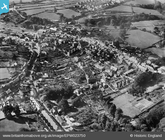
EPW023750 ENGLAND (1928). The town centre, Kingsbridge, 1928
© Copyright OpenStreetMap contributors and licensed by the OpenStreetMap Foundation. 2025. Cartography is licensed as CC BY-SA.
Nearby Images (7)
EPW023750

EPW023754

EPW033093

EPW023757

EPW033144

EPW033091

EPW023752

Details
| Title | [EPW023750] The town centre, Kingsbridge, 1928 |
| Reference | EPW023750 |
| Date | September-1928 |
| Link | |
| Place name | KINGSBRIDGE |
| Parish | KINGSBRIDGE |
| District | |
| Country | ENGLAND |
| Easting / Northing | 273533, 44433 |
| Longitude / Latitude | -3.7754085484935, 50.285669552505 |
| National Grid Reference | SX735444 |
Pins

MB |
Tuesday 6th of September 2016 09:17:00 PM | |
|
Amadis |
Sunday 22nd of December 2013 09:47:57 PM | |
Terminus of a branch line from Brent, on the GWR main line to the West of England. Closed in 1963. |
John W |
Friday 26th of August 2016 09:20:11 PM |
|
Amadis |
Sunday 22nd of December 2013 09:46:57 PM |