
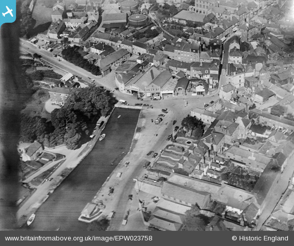
EPW023758 ENGLAND (1928). Prince of Wales Road and environs, Kingsbridge, 1928
© Copyright OpenStreetMap contributors and licensed by the OpenStreetMap Foundation. 2025. Cartography is licensed as CC BY-SA.
Nearby Images (7)
EPW023758

EPW023751

EPW033092

EPW033091

EPW023749

EPW033093

EPW033144

Details
| Title | [EPW023758] Prince of Wales Road and environs, Kingsbridge, 1928 |
| Reference | EPW023758 |
| Date | September-1928 |
| Link | |
| Place name | KINGSBRIDGE |
| Parish | KINGSBRIDGE |
| District | |
| Country | ENGLAND |
| Easting / Northing | 273507, 44093 |
| Longitude / Latitude | -3.7756595990912, 50.282607358323 |
| National Grid Reference | SX735441 |
Pins

MB |
Thursday 8th of November 2012 11:10:59 PM | |
|
MB |
Thursday 8th of November 2012 11:09:57 PM | |
|
MB |
Thursday 8th of November 2012 11:09:00 PM | |
|
MB |
Thursday 8th of November 2012 11:07:17 PM | |
|
MB |
Thursday 8th of November 2012 11:05:58 PM | |
|
MB |
Thursday 8th of November 2012 11:05:15 PM | |
|
MB |
Thursday 8th of November 2012 11:04:00 PM | |
|
MB |
Thursday 8th of November 2012 11:02:26 PM | |
|
MB |
Thursday 8th of November 2012 11:01:52 PM | |
|
MB |
Thursday 8th of November 2012 10:59:59 PM |