
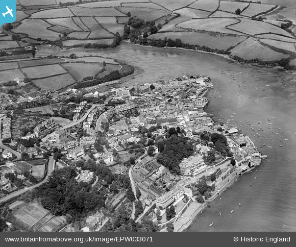
EPW033071 ENGLAND (1930). The town and surrounding countryside, Salcombe, 1930
© Copyright OpenStreetMap contributors and licensed by the OpenStreetMap Foundation. 2025. Cartography is licensed as CC BY-SA.
Nearby Images (11)
EPW033071

EPW033070

EPW033072

EPW024219

EAW007574

EPW033069

EPW024197

EPW024195

EPW024192

EPW024188

EPW024199

Details
| Title | [EPW033071] The town and surrounding countryside, Salcombe, 1930 |
| Reference | EPW033071 |
| Date | July-1930 |
| Link | |
| Place name | SALCOMBE |
| Parish | SALCOMBE |
| District | |
| Country | ENGLAND |
| Easting / Northing | 274003, 39078 |
| Longitude / Latitude | -3.7670312802909, 50.237627954969 |
| National Grid Reference | SX740391 |
Pins
Be the first to add a comment to this image!