
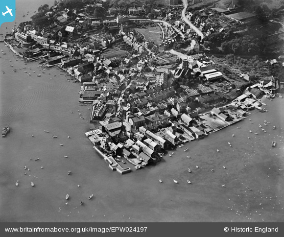
EPW024197 ENGLAND (1928). The town centre and waterfront, Salcombe, 1928
© Copyright OpenStreetMap contributors and licensed by the OpenStreetMap Foundation. 2025. Cartography is licensed as CC BY-SA.
Nearby Images (7)
EPW024197

EPW024188

EPW024219

EAW007574

EPW033071

EPW033072

EPW033070

Details
| Title | [EPW024197] The town centre and waterfront, Salcombe, 1928 |
| Reference | EPW024197 |
| Date | September-1928 |
| Link | |
| Place name | SALCOMBE |
| Parish | SALCOMBE |
| District | |
| Country | ENGLAND |
| Easting / Northing | 274095, 39235 |
| Longitude / Latitude | -3.7657938402972, 50.239059020299 |
| National Grid Reference | SX741392 |
Pins

redmist |
Sunday 24th of July 2022 10:51:43 PM | |

Class31 |
Tuesday 7th of August 2012 10:14:21 AM | |
|
Class31 |
Tuesday 7th of August 2012 10:13:56 AM | |
|
Class31 |
Tuesday 7th of August 2012 10:13:37 AM | |
|
Class31 |
Tuesday 7th of August 2012 10:13:08 AM |