
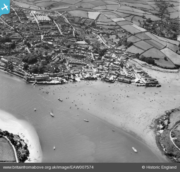
EAW007574 ENGLAND (1947). Salcombe waterfront and the entrance to Batson Creek, Salcombe, 1947
© Copyright OpenStreetMap contributors and licensed by the OpenStreetMap Foundation. 2025. Cartography is licensed as CC BY-SA.
Nearby Images (12)
EAW007574

EPW033072

EPW024195

EPW024192

EPW033071

EPW033069

EPW024199

EPW024219

EPW024197

EPW033070

EPW024188

EPW024193

Details
| Title | [EAW007574] Salcombe waterfront and the entrance to Batson Creek, Salcombe, 1947 |
| Reference | EAW007574 |
| Date | 25-June-1947 |
| Link | |
| Place name | SALCOMBE |
| Parish | SALCOMBE |
| District | |
| Country | ENGLAND |
| Easting / Northing | 274121, 39059 |
| Longitude / Latitude | -3.7653709261541, 50.237482287324 |
| National Grid Reference | SX741391 |
