
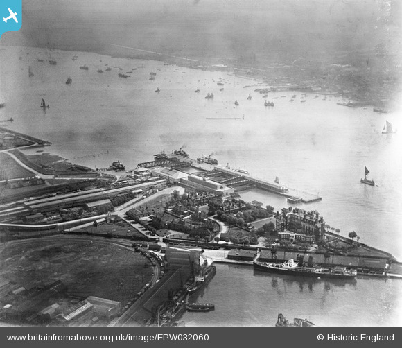
EPW032060 ENGLAND (1930). Tilbury Fort ( later Tilbury Riverside) railway station and environs, Tilbury, 1930
© Copyright OpenStreetMap contributors and licensed by the OpenStreetMap Foundation. 2026. Cartography is licensed as CC BY-SA.
Nearby Images (15)
EPW032060
 railway station and environs, Tilbury, 1930")
EPW044216

EPW044217

EPW032061
 railway station and environs, Tilbury, 1930")
EPW044227

EPW032063
 railway station and environs, Tilbury, 1930")
EPW044224

EAW014601

EPW032062
 railway station and environs, Tilbury, from the south, 1930")
EPW032065
 railway station and environs, Tilbury, 1930")
EAW014599

EPW024911

EAW014598

EAW028721

EPW032058
 railway station and environs, Tilbury, from the south-east, 1930")
Details
| Title | [EPW032060] Tilbury Fort ( later Tilbury Riverside) railway station and environs, Tilbury, 1930 |
| Reference | EPW032060 |
| Date | May-1930 |
| Link | |
| Place name | TILBURY |
| Parish | |
| District | |
| Country | ENGLAND |
| Easting / Northing | 564478, 175061 |
| Longitude / Latitude | 0.36735926875101, 51.450121743235 |
| National Grid Reference | TQ645751 |
Pins

Kentishman |
Monday 29th of August 2016 12:37:31 PM | |

Onthecoast |
Monday 3rd of December 2012 01:10:10 PM |
User Comment Contributions
See EPW032065. |
BigglesH |
Thursday 11th of April 2013 09:04:09 PM |