
EAW014599 ENGLAND (1948). RMS Strathaird in dock, Tilbury, 1948

© Copyright OpenStreetMap contributors and licensed by the OpenStreetMap Foundation. 2026. Cartography is licensed as CC BY-SA.
Nearby Images (17)
EAW014599

EAW014598

EPW044224

EAW014600

EPW032065
 railway station and environs, Tilbury, 1930")
EPW032063
 railway station and environs, Tilbury, 1930")
EAW014601

EPW044227

EAW028721

EPW032062
 railway station and environs, Tilbury, from the south, 1930")
EPW024911

EPW044226

EPW032061
 railway station and environs, Tilbury, 1930")
EPW044219

EPW044216

EPW032060
 railway station and environs, Tilbury, 1930")
EPW044217

Details
| Title | [EAW014599] RMS Strathaird in dock, Tilbury, 1948 |
| Reference | EAW014599 |
| Date | 16-April-1948 |
| Link | |
| Place name | TILBURY |
| Parish | |
| District | |
| Country | ENGLAND |
| Easting / Northing | 564268, 175067 |
| Longitude / Latitude | 0.3643422580002, 51.450236618905 |
| National Grid Reference | TQ643751 |
Pins

totoro |
Friday 17th of January 2014 07:09:59 PM | |
|
totoro |
Friday 17th of January 2014 07:06:30 PM | |
|
totoro |
Friday 17th of January 2014 06:59:28 PM | |
|
totoro |
Friday 17th of January 2014 06:57:26 PM |
User Comment Contributions
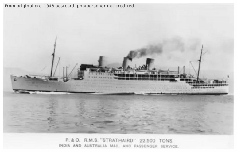
Ship with three funnels prior to 1948 |
totoro |
Friday 17th of January 2014 06:41:47 PM |