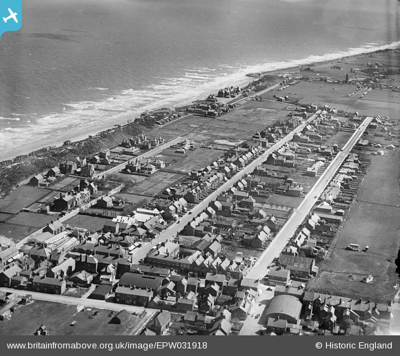
EPW031918 ENGLAND (1930). Victoria Road, George Street and environs, Mablethorpe, 1930
© Copyright OpenStreetMap contributors and licensed by the OpenStreetMap Foundation. 2026. Cartography is licensed as CC BY-SA.
Nearby Images (5)
Details
| Title | [EPW031918] Victoria Road, George Street and environs, Mablethorpe, 1930 |
| Reference | EPW031918 |
| Date | May-1930 |
| Link | |
| Place name | MABLETHORPE |
| Parish | MABLETHORPE AND SUTTON |
| District | |
| Country | ENGLAND |
| Easting / Northing | 550857, 384923 |
| Longitude / Latitude | 0.26608866673248, 53.339397988065 |
| National Grid Reference | TF509849 |


![[EPW031918] Victoria Road, George Street and environs, Mablethorpe, 1930](http://britainfromabove.org.uk/sites/all/libraries/aerofilms-images/public/100x100/EPW/031/EPW031918.jpg)
![[EPW031913] The town, Mablethorpe, 1930](http://britainfromabove.org.uk/sites/all/libraries/aerofilms-images/public/100x100/EPW/031/EPW031913.jpg)
![[EPW031911] The town and beach, Mablethorpe, 1930](http://britainfromabove.org.uk/sites/all/libraries/aerofilms-images/public/100x100/EPW/031/EPW031911.jpg)
![[EPW031914] The town, Mablethorpe, 1930](http://britainfromabove.org.uk/sites/all/libraries/aerofilms-images/public/100x100/EPW/031/EPW031914.jpg)
![[EPW031912] The High Street, Mablethorpe, 1930](http://britainfromabove.org.uk/sites/all/libraries/aerofilms-images/public/100x100/EPW/031/EPW031912.jpg)
