
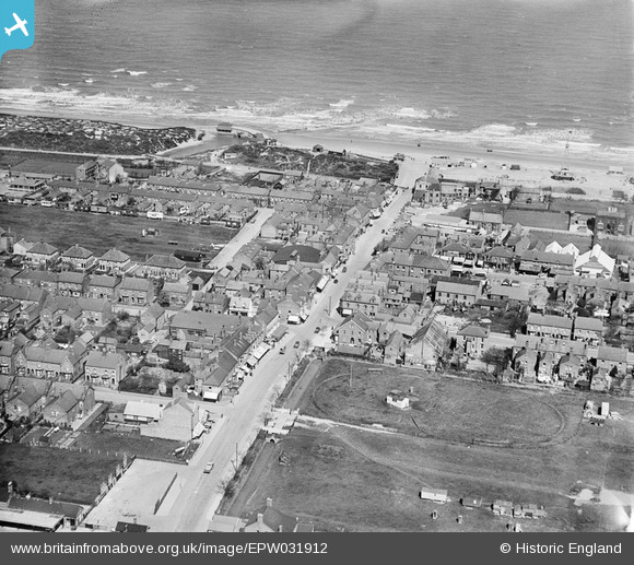
EPW031912 ENGLAND (1930). The High Street, Mablethorpe, 1930
© Copyright OpenStreetMap contributors and licensed by the OpenStreetMap Foundation. 2026. Cartography is licensed as CC BY-SA.
Nearby Images (4)
EPW031912

EPW031915

EPW031914

EPW031918

Details
| Title | [EPW031912] The High Street, Mablethorpe, 1930 |
| Reference | EPW031912 |
| Date | May-1930 |
| Link | |
| Place name | MABLETHORPE |
| Parish | MABLETHORPE AND SUTTON |
| District | |
| Country | ENGLAND |
| Easting / Northing | 550632, 385157 |
| Longitude / Latitude | 0.26282305977966, 53.341564046077 |
| National Grid Reference | TF506852 |
Pins

Ian |
Sunday 15th of September 2013 02:26:35 PM | |
|
Ian |
Sunday 15th of September 2013 02:25:37 PM | |
|
Ian |
Sunday 15th of September 2013 02:23:39 PM | |
|
Ian |
Sunday 15th of September 2013 02:16:23 PM | |
|
Ian |
Sunday 15th of September 2013 02:12:55 PM | |
It's the fairground |
Julie |
Saturday 15th of August 2015 08:46:20 PM |
|
Ian |
Sunday 15th of September 2013 02:09:07 PM | |
|
Ian |
Sunday 15th of September 2013 02:05:35 PM | |
|
Ian |
Sunday 15th of September 2013 01:55:09 PM |


