
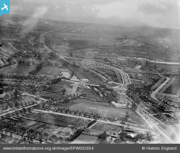
EPW031654 ENGLAND (1930). Watford Way and Central Circus, Hendon, from the north, 1930
© Copyright OpenStreetMap contributors and licensed by the OpenStreetMap Foundation. 2026. Cartography is licensed as CC BY-SA.
Nearby Images (8)
EPW031654

EPW031656

EPW031653

EPW016638

EPW016523

EPW016521

EPW008746

EPW031659

Details
| Title | [EPW031654] Watford Way and Central Circus, Hendon, from the north, 1930 |
| Reference | EPW031654 |
| Date | April-1930 |
| Link | |
| Place name | HENDON |
| Parish | |
| District | |
| Country | ENGLAND |
| Easting / Northing | 522901, 188852 |
| Longitude / Latitude | -0.22589519716573, 51.584631636153 |
| National Grid Reference | TQ229889 |
Pins

Digitalsnapper |
Wednesday 26th of January 2022 08:38:20 PM | |
|
Digitalsnapper |
Wednesday 26th of January 2022 08:36:26 PM | |
|
Digitalsnapper |
Wednesday 26th of January 2022 08:34:35 PM |