
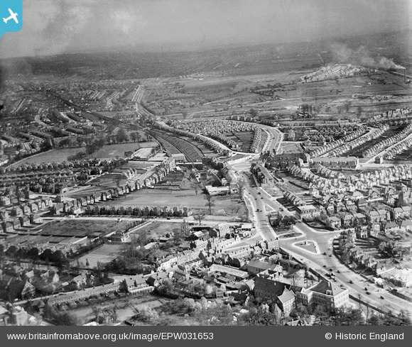
EPW031653 ENGLAND (1930). Watford Way and Central Circus, Hendon, from the north-west, 1930
© Copyright OpenStreetMap contributors and licensed by the OpenStreetMap Foundation. 2026. Cartography is licensed as CC BY-SA.
Nearby Images (4)
EPW031653

EPW031654

EPR000512

EPW031656

Details
| Title | [EPW031653] Watford Way and Central Circus, Hendon, from the north-west, 1930 |
| Reference | EPW031653 |
| Date | April-1930 |
| Link | |
| Place name | HENDON |
| Parish | |
| District | |
| Country | ENGLAND |
| Easting / Northing | 522736, 188919 |
| Longitude / Latitude | -0.22825235542964, 51.585269804419 |
| National Grid Reference | TQ227889 |
Pins

ken |
Wednesday 14th of October 2015 07:56:45 PM | |
|
ken |
Wednesday 14th of October 2015 07:55:49 PM | |
|
Wordsmith52 |
Tuesday 7th of October 2014 01:21:00 PM |