
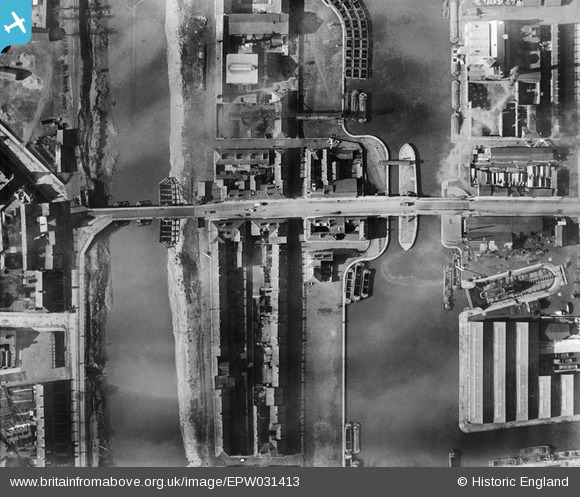
EPW031413 ENGLAND (1930). The Dutch River, the Barge Dock and Old Goole Bridge, Goole, 1930
© Copyright OpenStreetMap contributors and licensed by the OpenStreetMap Foundation. 2026. Cartography is licensed as CC BY-SA.
Nearby Images (9)
EPW031413

EAW046155

EPW048854

EAW022515

EPW012840

EPW031412

EAW046154

EAW046152

EPW031414

Details
| Title | [EPW031413] The Dutch River, the Barge Dock and Old Goole Bridge, Goole, 1930 |
| Reference | EPW031413 |
| Date | February-1930 |
| Link | |
| Place name | GOOLE |
| Parish | GOOLE |
| District | |
| Country | ENGLAND |
| Easting / Northing | 474476, 422871 |
| Longitude / Latitude | -0.8718732334116, 53.696734715274 |
| National Grid Reference | SE745229 |
Pins
Be the first to add a comment to this image!
