
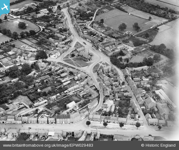
EPW029483 ENGLAND (1929). The town centre, Easingwold, 1929
© Copyright OpenStreetMap contributors and licensed by the OpenStreetMap Foundation. 2025. Cartography is licensed as CC BY-SA.
Nearby Images (5)
EPW029483

EPW029480

EPW029479

EPW029482

EPW029481

Details
| Title | [EPW029483] The town centre, Easingwold, 1929 |
| Reference | EPW029483 |
| Date | September-1929 |
| Link | |
| Place name | EASINGWOLD |
| Parish | EASINGWOLD |
| District | |
| Country | ENGLAND |
| Easting / Northing | 452863, 469782 |
| Longitude / Latitude | -1.191107421777, 54.121004258851 |
| National Grid Reference | SE529698 |
Pins

MB |
Friday 19th of April 2013 03:23:53 PM | |
|
MB |
Friday 19th of April 2013 03:22:44 PM | |
|
MB |
Friday 19th of April 2013 03:21:55 PM | |
|
MB |
Friday 19th of April 2013 03:21:05 PM | |
|
MB |
Friday 19th of April 2013 03:20:39 PM | |
|
MB |
Friday 19th of April 2013 03:19:55 PM | |
|
MB |
Friday 19th of April 2013 03:19:27 PM | |
|
MB |
Friday 19th of April 2013 03:19:09 PM | |
|
MB |
Friday 19th of April 2013 03:18:16 PM | |
|
MB |
Friday 19th of April 2013 03:17:58 PM | |
|
MB |
Friday 19th of April 2013 03:17:38 PM | |
|
MB |
Friday 19th of April 2013 03:17:20 PM | |
|
MB |
Friday 19th of April 2013 03:16:53 PM | |
|
MB |
Friday 19th of April 2013 03:16:24 PM | |
|
MB |
Friday 19th of April 2013 03:15:58 PM |