
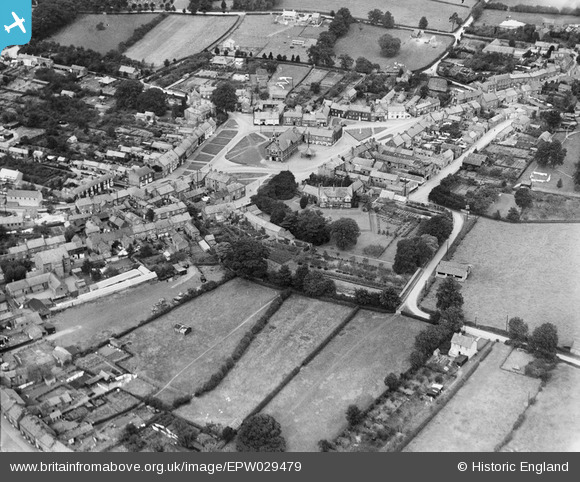
EPW029479 ENGLAND (1929). The Market Place, Town Hall and town centre, Easingwold, 1929
© Copyright OpenStreetMap contributors and licensed by the OpenStreetMap Foundation. 2025. Cartography is licensed as CC BY-SA.
Nearby Images (5)
EPW029479

EPW029483

EPW029480

EPW029481

EPW029482

Details
| Title | [EPW029479] The Market Place, Town Hall and town centre, Easingwold, 1929 |
| Reference | EPW029479 |
| Date | September-1929 |
| Link | |
| Place name | EASINGWOLD |
| Parish | EASINGWOLD |
| District | |
| Country | ENGLAND |
| Easting / Northing | 452950, 469737 |
| Longitude / Latitude | -1.1897842119561, 54.120590863089 |
| National Grid Reference | SE530697 |
Pins
Be the first to add a comment to this image!