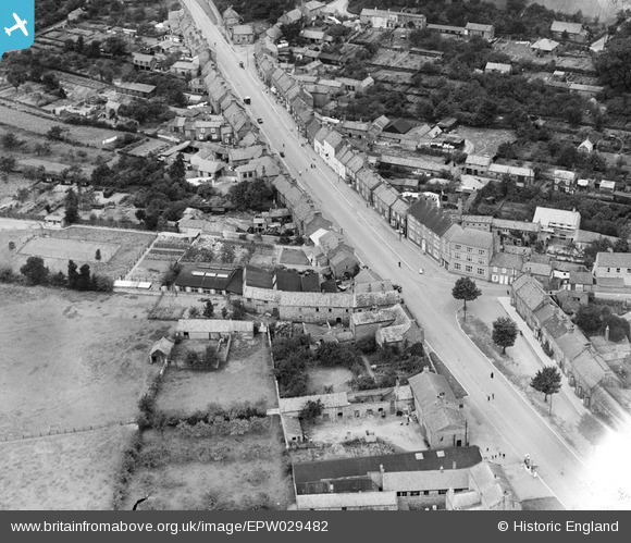
EPW029482 ENGLAND (1929). Long Street, Easingwold, 1929
© Copyright OpenStreetMap contributors and licensed by the OpenStreetMap Foundation. 2025. Cartography is licensed as CC BY-SA.
Nearby Images (5)
Details
| Title | [EPW029482] Long Street, Easingwold, 1929 |
| Reference | EPW029482 |
| Date | September-1929 |
| Link | |
| Place name | EASINGWOLD |
| Parish | EASINGWOLD |
| District | |
| Country | ENGLAND |
| Easting / Northing | 452724, 469659 |
| Longitude / Latitude | -1.1932555929886, 54.11991305221 |
| National Grid Reference | SE527697 |
Pins
Be the first to add a comment to this image!


![[EPW029482] Long Street, Easingwold, 1929](http://britainfromabove.org.uk/sites/all/libraries/aerofilms-images/public/100x100/EPW/029/EPW029482.jpg)
![[EPW029481] Long Street, Easingwold, 1929](http://britainfromabove.org.uk/sites/all/libraries/aerofilms-images/public/100x100/EPW/029/EPW029481.jpg)
![[EPW029483] The town centre, Easingwold, 1929](http://britainfromabove.org.uk/sites/all/libraries/aerofilms-images/public/100x100/EPW/029/EPW029483.jpg)
![[EPW029480] The Market Place, Town Hall and town centre, Easingwold, 1929](http://britainfromabove.org.uk/sites/all/libraries/aerofilms-images/public/100x100/EPW/029/EPW029480.jpg)
![[EPW029479] The Market Place, Town Hall and town centre, Easingwold, 1929](http://britainfromabove.org.uk/sites/all/libraries/aerofilms-images/public/100x100/EPW/029/EPW029479.jpg)