
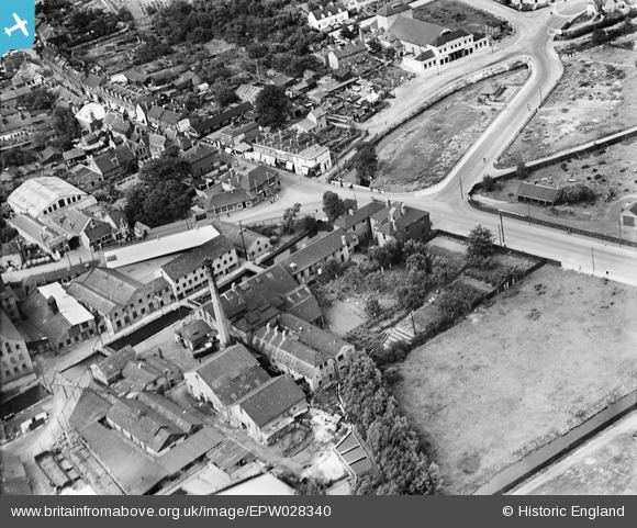
EPW028340 ENGLAND (1929). Crayford Tannery, Crayford, 1929
© Copyright OpenStreetMap contributors and licensed by the OpenStreetMap Foundation. 2026. Cartography is licensed as CC BY-SA.
Nearby Images (8)
EPW028340

EPR000356

EPR000354

EPR000358

EPR000357

EPR000355

EAW048622

EPW028338

Details
| Title | [EPW028340] Crayford Tannery, Crayford, 1929 |
| Reference | EPW028340 |
| Date | August-1929 |
| Link | |
| Place name | CRAYFORD |
| Parish | |
| District | |
| Country | ENGLAND |
| Easting / Northing | 551442, 174733 |
| Longitude / Latitude | 0.17974177513107, 51.450811497175 |
| National Grid Reference | TQ514747 |
Pins

Andrew |
Friday 22nd of April 2022 02:20:30 PM | |
|
Andrew |
Thursday 6th of May 2021 11:29:12 AM | |

Barney |
Wednesday 13th of May 2015 01:29:25 PM | |
|
Barney |
Wednesday 13th of May 2015 01:27:03 PM | |
|
Barney |
Wednesday 13th of May 2015 01:25:29 PM | |
Crayford Arms is next door. The pinned building is in fact what was once part of a larger manor house where Sir Cloudesley Shovell once lived. It is now (since the 1980's) home to Crayford Kebab. |
Elliot |
Thursday 31st of July 2025 12:32:09 PM |
|
kevininkent |
Monday 10th of March 2014 10:58:47 AM | |
|
kevininkent |
Monday 10th of March 2014 10:57:10 AM |