
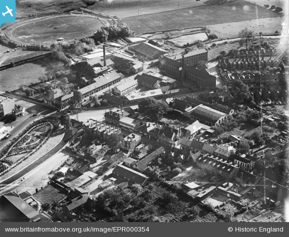
EPR000354 ENGLAND (1934). The High Street, Crayford Bridge and environs, Crayford, 1934. This image was marked by Aero Pictorial Ltd for photo editing.
© Copyright OpenStreetMap contributors and licensed by the OpenStreetMap Foundation. 2026. Cartography is licensed as CC BY-SA.
Nearby Images (10)
EPR000354

EPW028340

EPR000358

EPR000356

EPR000355

EPR000357

EAW048621

EAW048622

EPW028338

EAW048608

Details
| Title | [EPR000354] The High Street, Crayford Bridge and environs, Crayford, 1934. This image was marked by Aero Pictorial Ltd for photo editing. |
| Reference | EPR000354 |
| Date | 25-September-1934 |
| Link | |
| Place name | CRAYFORD |
| Parish | |
| District | |
| Country | ENGLAND |
| Easting / Northing | 551401, 174782 |
| Longitude / Latitude | 0.17917308324732, 51.45126278039 |
| National Grid Reference | TQ514748 |
Pins

Elliot |
Tuesday 2nd of June 2026 01:31:31 PM | |
|
Elliot |
Thursday 31st of July 2025 01:34:30 PM | |
|
Elliot |
Thursday 31st of July 2025 01:34:01 PM | |

Barney |
Tuesday 3rd of August 2021 02:43:41 PM | |
|
Nigel |
Thursday 3rd of December 2020 09:01:46 AM | |
|
Nigel |
Thursday 3rd of December 2020 08:59:50 AM | |
|
Nigel |
Thursday 3rd of December 2020 08:59:00 AM | |
|
Barney |
Monday 22nd of June 2015 01:46:02 PM |
