
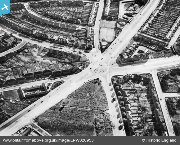
EPW026953 ENGLAND (1929). Gants Hill roundabout, Gants Hill, 1929. This image has been produced from a copy-negative.
© Copyright OpenStreetMap contributors and licensed by the OpenStreetMap Foundation. 2026. Cartography is licensed as CC BY-SA.
Nearby Images (6)
EPW026953

EPW026954

EPW026955

EPW043388

EPW024296

EPW043391

Details
| Title | [EPW026953] Gants Hill roundabout, Gants Hill, 1929. This image has been produced from a copy-negative. |
| Reference | EPW026953 |
| Date | May-1929 |
| Link | |
| Place name | GANTS HILL |
| Parish | |
| District | |
| Country | ENGLAND |
| Easting / Northing | 543307, 188408 |
| Longitude / Latitude | 0.068297066183911, 51.575821448385 |
| National Grid Reference | TQ433884 |
Pins
Be the first to add a comment to this image!