
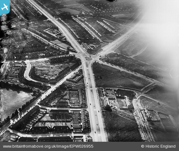
EPW026955 ENGLAND (1929). Gants Hill roundabout, Gants Hill, 1929
© Copyright OpenStreetMap contributors and licensed by the OpenStreetMap Foundation. 2026. Cartography is licensed as CC BY-SA.
Nearby Images (5)
EPW026955

EPW026954

EPW026953

EPW043388

EPW043391

Details
| Title | [EPW026955] Gants Hill roundabout, Gants Hill, 1929 |
| Reference | EPW026955 |
| Date | May-1929 |
| Link | |
| Place name | GANTS HILL |
| Parish | |
| District | |
| Country | ENGLAND |
| Easting / Northing | 543388, 188407 |
| Longitude / Latitude | 0.069464880416355, 51.575791861267 |
| National Grid Reference | TQ434884 |
Pins
Be the first to add a comment to this image!