
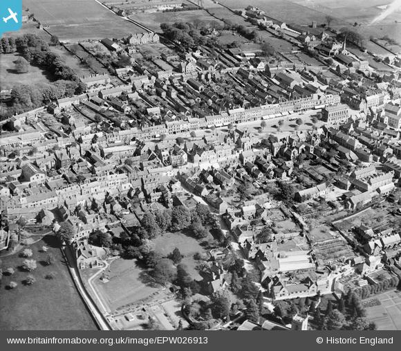
EPW026913 ENGLAND (1929). The town centre, Chipping Norton, 1929
© Copyright OpenStreetMap contributors and licensed by the OpenStreetMap Foundation. 2026. Cartography is licensed as CC BY-SA.
Nearby Images (12)
EPW026913

EAW049010

EAW049014

EPW026911

EPW026905

EAW049013

EPW026906

EAW049012

EPW026910

EPW026904

EPW026914

EPW026912

Details
| Title | [EPW026913] The town centre, Chipping Norton, 1929 |
| Reference | EPW026913 |
| Date | May-1929 |
| Link | |
| Place name | CHIPPING NORTON |
| Parish | CHIPPING NORTON |
| District | |
| Country | ENGLAND |
| Easting / Northing | 431339, 227226 |
| Longitude / Latitude | -1.5440414039248, 51.942219531075 |
| National Grid Reference | SP313272 |
Pins

David960 |
Monday 11th of September 2017 11:42:56 AM | |
|
alastair wallace |
Tuesday 29th of September 2015 05:37:13 PM |