
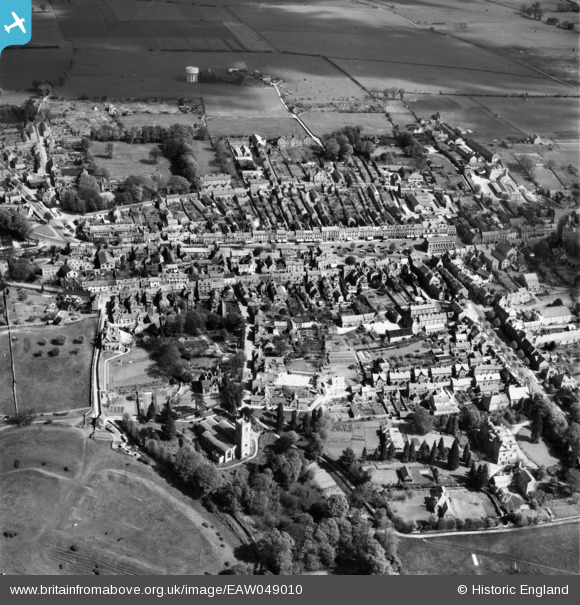
EAW049010 ENGLAND (1953). The town centre, Chipping Norton, 1953
© Copyright OpenStreetMap contributors and licensed by the OpenStreetMap Foundation. 2026. Cartography is licensed as CC BY-SA.
Nearby Images (13)
EAW049010

EPW026913

EAW049014

EPW026905

EPW026911

EPW026906

EAW049013

EPW026904

EAW049012

EPW026910

EPW026914

EPW026909

EPW026912

Details
| Title | [EAW049010] The town centre, Chipping Norton, 1953 |
| Reference | EAW049010 |
| Date | 5-May-1953 |
| Link | |
| Place name | CHIPPING NORTON |
| Parish | CHIPPING NORTON |
| District | |
| Country | ENGLAND |
| Easting / Northing | 431320, 227212 |
| Longitude / Latitude | -1.5443191055406, 51.942094719637 |
| National Grid Reference | SP313272 |
Pins

tony |
Wednesday 11th of February 2015 06:57:49 PM |