
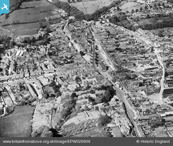
EPW026906 ENGLAND (1929). The town centre, Chipping Norton, 1929
© Copyright OpenStreetMap contributors and licensed by the OpenStreetMap Foundation. 2026. Cartography is licensed as CC BY-SA.
Nearby Images (9)
EPW026906

EPW026904

EPW026905

EPW026909

EPW026911

EAW049010

EAW049011

EPW026913

EAW049014

Details
| Title | [EPW026906] The town centre, Chipping Norton, 1929 |
| Reference | EPW026906 |
| Date | May-1929 |
| Link | |
| Place name | CHIPPING NORTON |
| Parish | CHIPPING NORTON |
| District | |
| Country | ENGLAND |
| Easting / Northing | 431297, 227059 |
| Longitude / Latitude | -1.5446676545388, 51.940720307726 |
| National Grid Reference | SP313271 |
Pins
Be the first to add a comment to this image!