
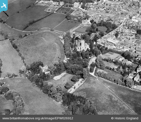
EPW026912 ENGLAND (1929). St Mary's Church and Chipping Norton Castle, Chipping Norton, 1929
© Copyright OpenStreetMap contributors and licensed by the OpenStreetMap Foundation. 2026. Cartography is licensed as CC BY-SA.
Nearby Images (4)
EPW026912

EPW026914

EAW049010

EPW026913

Details
| Title | [EPW026912] St Mary's Church and Chipping Norton Castle, Chipping Norton, 1929 |
| Reference | EPW026912 |
| Date | May-1929 |
| Link | |
| Place name | CHIPPING NORTON |
| Parish | CHIPPING NORTON |
| District | |
| Country | ENGLAND |
| Easting / Northing | 431103, 227367 |
| Longitude / Latitude | -1.547462150211, 51.943500585983 |
| National Grid Reference | SP311274 |
Pins
Be the first to add a comment to this image!