
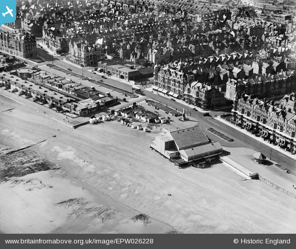
EPW026228 ENGLAND (1929). The Kursaal, Bexhill, 1929
© Copyright OpenStreetMap contributors and licensed by the OpenStreetMap Foundation. 2026. Cartography is licensed as CC BY-SA.
Nearby Images (10)
EPW026228

EPW016888

EPW026223

EPW000121

EPW039351

EAW022974

EPW026226

EPW000708

EPW026229

EPW000741

Details
| Title | [EPW026228] The Kursaal, Bexhill, 1929 |
| Reference | EPW026228 |
| Date | 24-April-1929 |
| Link | |
| Place name | BEXHILL |
| Parish | |
| District | |
| Country | ENGLAND |
| Easting / Northing | 574470, 107166 |
| Longitude / Latitude | 0.47813307213698, 50.837126625174 |
| National Grid Reference | TQ745072 |
Pins
Be the first to add a comment to this image!
User Comment Contributions
It appears 'The Kursaal' became 'The Pavilion' sometime between 1914 and 1918. It was later replaced as the town's entertainment venue by the De La Warr Pavilion, a little further to the west behind the colonnade seen in EPW000120 |

Maurice |
Tuesday 4th of March 2014 08:10:48 AM |