
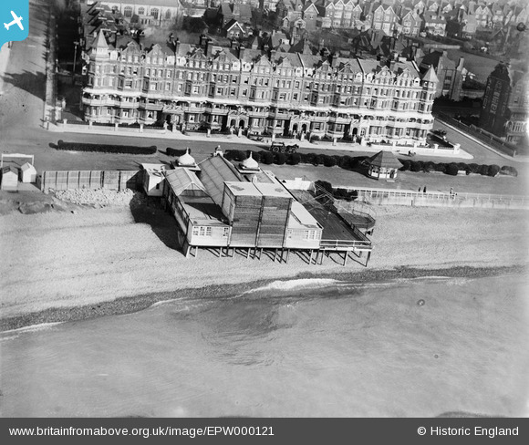
EPW000121 ENGLAND (1920). The Pavilion, De La Warr Parade, Bexhill, 1920
© Copyright OpenStreetMap contributors and licensed by the OpenStreetMap Foundation. 2026. Cartography is licensed as CC BY-SA.
Nearby Images (10)
EPW000121

EPW039351

EPW016888

EPW026228

EPW026223

EAW022974

EPW000708

EPW026226

EPW026229

EPW000741

Details
| Title | [EPW000121] The Pavilion, De La Warr Parade, Bexhill, 1920 |
| Reference | EPW000121 |
| Date | February-1920 |
| Link | |
| Place name | BEXHILL |
| Parish | |
| District | |
| Country | ENGLAND |
| Easting / Northing | 574520, 107137 |
| Longitude / Latitude | 0.47882873905426, 50.836850979669 |
| National Grid Reference | TQ745071 |
Pins
Be the first to add a comment to this image!
User Comment Contributions
Yes, interesting to compare it with the 1926 photo that shows the Kursaal's later roof. |

flakdodger |
Tuesday 26th of June 2012 09:23:56 AM |
as all Bexhillians will know, this is the Kursaal as opposed to the De La Warr Pavilion, which dates from 1935 |

wimsey |
Monday 25th of June 2012 05:29:06 AM |