
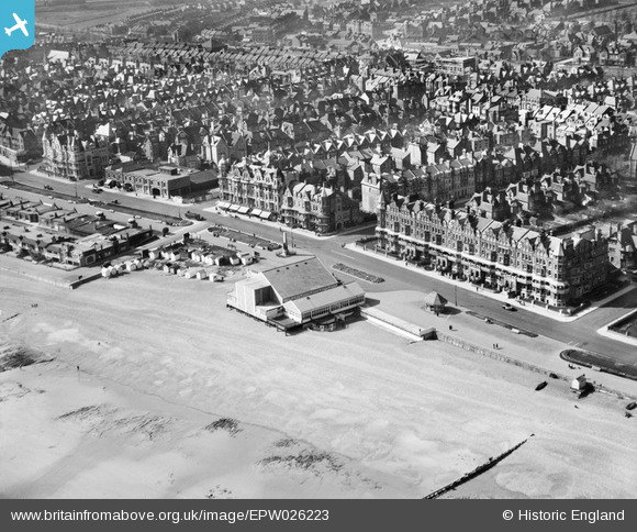
EPW026223 ENGLAND (1929). The Kursaal, Bexhill, 1929
© Copyright OpenStreetMap contributors and licensed by the OpenStreetMap Foundation. 2026. Cartography is licensed as CC BY-SA.
Nearby Images (10)
EPW026223

EPW016888

EPW026228

EPW039351

EPW000121

EAW022974

EPW026229

EPW026226

EPW000708

EPW000741

Details
| Title | [EPW026223] The Kursaal, Bexhill, 1929 |
| Reference | EPW026223 |
| Date | 24-April-1929 |
| Link | |
| Place name | BEXHILL |
| Parish | |
| District | |
| Country | ENGLAND |
| Easting / Northing | 574487, 107194 |
| Longitude / Latitude | 0.47838762868179, 50.837373082293 |
| National Grid Reference | TQ745072 |
Pins
Be the first to add a comment to this image!