
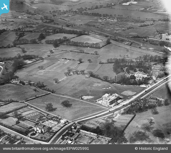
EPW025991 ENGLAND (1929). Hanger Hill Park and Greystoke Court under construction, Ealing, 1929
© Copyright OpenStreetMap contributors and licensed by the OpenStreetMap Foundation. 2026. Cartography is licensed as CC BY-SA.
Nearby Images (21)
EPW025991

EPW025990

EPW025996

EPW025994

EPW025997

EPW025989

EPW025998

EPW025992

EAW015158

EPW040864

EAW015159

EAW015161

EPW040866

EAW015160

EPW025995

EPW025999

EPW040863

EPW025993

EPW026000

EPW040873

EPW040874

Details
| Title | [EPW025991] Hanger Hill Park and Greystoke Court under construction, Ealing, 1929 |
| Reference | EPW025991 |
| Date | 6-April-1929 |
| Link | |
| Place name | EALING |
| Parish | |
| District | |
| Country | ENGLAND |
| Easting / Northing | 518343, 182299 |
| Longitude / Latitude | -0.29386471097053, 51.526706308753 |
| National Grid Reference | TQ183823 |
Pins

Class31 |
Monday 24th of March 2014 11:38:26 AM |