
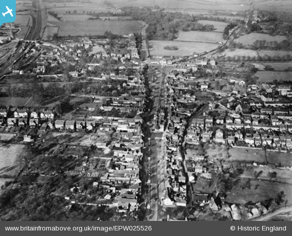
EPW025526 ENGLAND (1928). The High Street, Stevenage, 1928. This image has been produced from a copy-negative.
© Copyright OpenStreetMap contributors and licensed by the OpenStreetMap Foundation. 2026. Cartography is licensed as CC BY-SA.
Nearby Images (9)
EPW025526

EAW034137

EAW023208

EPW013409

EAW034136

EPW013411

EPW025524

EAW023206

EAW023207

Details
| Title | [EPW025526] The High Street, Stevenage, 1928. This image has been produced from a copy-negative. |
| Reference | EPW025526 |
| Date | 14-November-1928 |
| Link | |
| Place name | STEVENAGE |
| Parish | |
| District | |
| Country | ENGLAND |
| Easting / Northing | 523339, 225179 |
| Longitude / Latitude | -0.20668949146559, 51.911033919407 |
| National Grid Reference | TL233252 |
Pins

paulinuk |
Thursday 11th of February 2021 01:40:15 PM | |
|
paulinuk |
Thursday 11th of February 2021 01:37:17 PM | |

melgibbs |
Thursday 19th of March 2015 09:02:34 PM |