
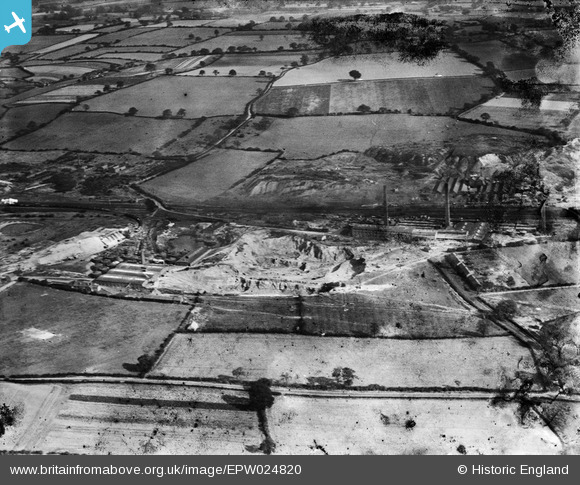
EPW024820 ENGLAND (1928). The Stoneware Limited Works, Dosthill, 1928
© Copyright OpenStreetMap contributors and licensed by the OpenStreetMap Foundation. 2026. Cartography is licensed as CC BY-SA.
Nearby Images (24)
EPW024820

EPW024603

EPW044460

EPW024609

EPW024601

EPW044459

EPW024600

EPW024599

EPW024605

EPW024596

EPW024607

EPW044458

EPW024608

EPW024595

EPW024604

EPW044461

EPW044462

EPW024611

EPW044463

EPW024598

EPW024610

EPW024597

EPW044464

EPW024639

Details
| Title | [EPW024820] The Stoneware Limited Works, Dosthill, 1928 |
| Reference | EPW024820 |
| Date | September-1928 |
| Link | |
| Place name | DOSTHILL |
| Parish | KINGSBURY |
| District | |
| Country | ENGLAND |
| Easting / Northing | 421756, 299312 |
| Longitude / Latitude | -1.6788142221705, 52.590816103117 |
| National Grid Reference | SP218993 |
Pins

johnny {strip} |
Tuesday 28th of May 2013 12:32:21 PM | |
|
johnny {strip} |
Monday 18th of March 2013 09:59:19 PM | |
|
johnny {strip} |
Monday 18th of March 2013 09:55:31 PM | |
|
johnny {strip} |
Monday 18th of March 2013 09:51:44 PM | |
|
johnny {strip} |
Monday 18th of March 2013 09:50:05 PM | |
|
johnny {strip} |
Monday 18th of March 2013 09:48:07 PM |