
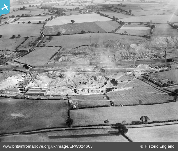
EPW024603 ENGLAND (1928). The Stoneware Limited Works and clay pits, Whateley, 1928
© Copyright OpenStreetMap contributors and licensed by the OpenStreetMap Foundation. 2026. Cartography is licensed as CC BY-SA.
Nearby Images (24)
EPW024603

EPW024820

EPW044460

EPW024601

EPW024609

EPW024605

EPW044459

EPW024600

EPW024596

EPW024599

EPW044458

EPW024608

EPW024604

EPW024607

EPW024595

EPW044462

EPW044461

EPW024611

EPW044463

EPW024598

EPW044464

EPW024610

EPW024597

EPW024639

Details
| Title | [EPW024603] The Stoneware Limited Works and clay pits, Whateley, 1928 |
| Reference | EPW024603 |
| Date | September-1928 |
| Link | |
| Place name | WHATELEY |
| Parish | KINGSBURY |
| District | |
| Country | ENGLAND |
| Easting / Northing | 421768, 299320 |
| Longitude / Latitude | -1.6786365419481, 52.590887548159 |
| National Grid Reference | SP218993 |
