
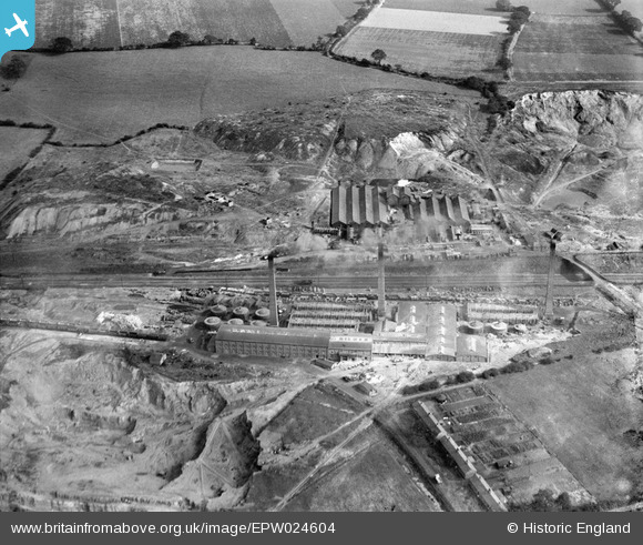
EPW024604 ENGLAND (1928). The Stoneware Limited Works and Whateley Colliery and Brick Works, Whateley, 1928
© Copyright OpenStreetMap contributors and licensed by the OpenStreetMap Foundation. 2026. Cartography is licensed as CC BY-SA.
Nearby Images (24)
EPW024604

EPW024599

EPW024601

EPW044459

EPW024595

EPW024603

EPW024820

EPW044460

EPW024609

EPW024600

EPW024605

EPW044463

EPW024598

EPW024607

EPW024611

EPW024610

EPW024596

EPW024597

EPW044458

EPW024608

EPW044461

EPW044462

EPW044464

EPW024639

Details
| Title | [EPW024604] The Stoneware Limited Works and Whateley Colliery and Brick Works, Whateley, 1928 |
| Reference | EPW024604 |
| Date | September-1928 |
| Link | |
| Place name | WHATELEY |
| Parish | KINGSBURY |
| District | |
| Country | ENGLAND |
| Easting / Northing | 421839, 299200 |
| Longitude / Latitude | -1.6775962970756, 52.589805815894 |
| National Grid Reference | SP218992 |
Pins
Be the first to add a comment to this image!
User Comment Contributions
I would love to share this photo on my Facebook group, tamworths history in photos |

lendl43@aol.co.uk |
Thursday 26th of July 2012 09:24:14 PM |