
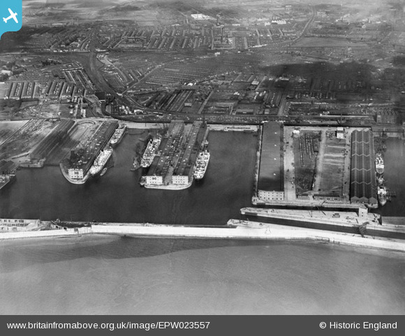
EPW023557 ENGLAND (1928). Gladstone Docks, Bootle, 1928
© Copyright OpenStreetMap contributors and licensed by the OpenStreetMap Foundation. 2026. Cartography is licensed as CC BY-SA.
Nearby Images (19)
EPW023557

EPW023556

EPW023554

EPW018898

EPW050114

EPW053296

EPW018922

EPW018921

EPW023558

EAW051426

EPW023555

EPW018872

EPW018923

EAW004633

EPW053310

EAW004632

EPW018873

EPW018920

EAW042532

Details
| Title | [EPW023557] Gladstone Docks, Bootle, 1928 |
| Reference | EPW023557 |
| Date | October-1928 |
| Link | |
| Place name | BOOTLE |
| Parish | |
| District | |
| Country | ENGLAND |
| Easting / Northing | 332628, 395767 |
| Longitude / Latitude | -3.0146883920162, 53.454090831754 |
| National Grid Reference | SJ326958 |
Pins

Ronnie |
Saturday 28th of October 2017 03:53:03 PM |