
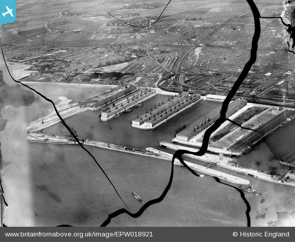
EPW018921 ENGLAND (1927). Gladstone Dock, Bootle, 1927. This image has been produced from a damaged negative.
© Copyright OpenStreetMap contributors and licensed by the OpenStreetMap Foundation. 2026. Cartography is licensed as CC BY-SA.
Nearby Images (18)
EPW018921

EPW023554

EPW053296

EPW018872

EPW023556

EPW023557

EPW018898

EAW004633

EPW050114

EAW051426

EPW023555

EPW018873

EAW004632

EPW018922

EPW023558

EPW053309

EAW004630

EPW050661

Details
| Title | [EPW018921] Gladstone Dock, Bootle, 1927. This image has been produced from a damaged negative. |
| Reference | EPW018921 |
| Date | 17-July-1927 |
| Link | |
| Place name | BOOTLE |
| Parish | |
| District | |
| Country | ENGLAND |
| Easting / Northing | 332554, 395832 |
| Longitude / Latitude | -3.0158166553426, 53.454665590076 |
| National Grid Reference | SJ326958 |
Pins

rivermersey |
Saturday 26th of March 2022 06:41:43 PM | |
|
rivermersey |
Thursday 22nd of July 2021 02:21:35 PM | |
|
rivermersey |
Thursday 22nd of July 2021 02:19:40 PM | |
|
gBr |
Wednesday 19th of June 2019 11:17:23 PM | |
|
gBr |
Wednesday 19th of June 2019 11:15:44 PM | |
|
gBr |
Wednesday 19th of June 2019 11:14:14 PM | |
|
gBr |
Wednesday 19th of June 2019 11:07:08 PM | |
|
gBr |
Wednesday 19th of June 2019 11:03:13 PM |