
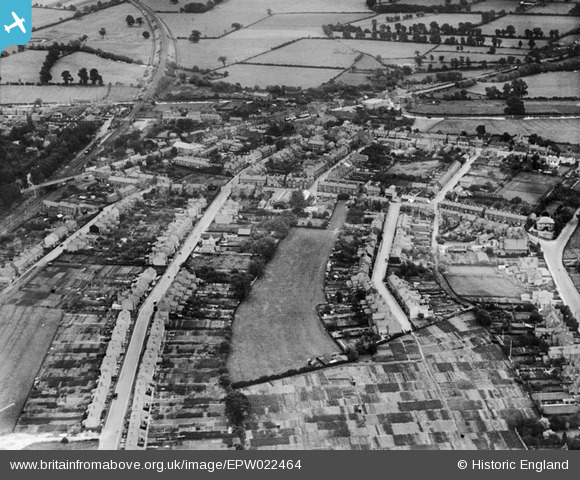
EPW022464 ENGLAND (1928). Western Road and environs, Fenny Stratford, 1928
© Copyright OpenStreetMap contributors and licensed by the OpenStreetMap Foundation. 2026. Cartography is licensed as CC BY-SA.
Nearby Images (4)
EPW022464

EPW022466

EPW056951

EPW022467

Details
| Title | [EPW022464] Western Road and environs, Fenny Stratford, 1928 |
| Reference | EPW022464 |
| Date | 9-August-1928 |
| Link | |
| Place name | FENNY STRATFORD |
| Parish | BLETCHLEY AND FENNY STRATFORD |
| District | |
| Country | ENGLAND |
| Easting / Northing | 487908, 234046 |
| Longitude / Latitude | -0.71940934063985, 51.997465235012 |
| National Grid Reference | SP879340 |
Pins

Class31 |
Wednesday 24th of October 2012 11:21:25 PM | |
|
Class31 |
Wednesday 24th of October 2012 11:19:39 PM | |
|
Class31 |
Wednesday 24th of October 2012 11:19:02 PM | |
|
Class31 |
Wednesday 24th of October 2012 11:18:44 PM | |
|
Class31 |
Wednesday 24th of October 2012 11:17:40 PM | |
|
Class31 |
Wednesday 24th of October 2012 11:17:17 PM | |
|
Class31 |
Wednesday 24th of October 2012 11:16:16 PM | |
|
Class31 |
Wednesday 24th of October 2012 11:15:35 PM | |
|
Class31 |
Wednesday 24th of October 2012 11:13:35 PM |
User Comment Contributions
View looking east. |
Class31 |
Wednesday 24th of October 2012 11:16:36 PM |