
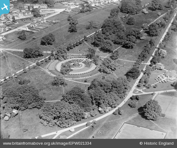
EPW021334 ENGLAND (1928). The band stand and Cassiobury Park, Watford, 1928
© Copyright OpenStreetMap contributors and licensed by the OpenStreetMap Foundation. 2026. Cartography is licensed as CC BY-SA.
Nearby Images (8)
EPW021334

EAW018527

EPW019231

EPW019232

EPW019233

EAW002183

EPW039631

EPW019234

Details
| Title | [EPW021334] The band stand and Cassiobury Park, Watford, 1928 |
| Reference | EPW021334 |
| Date | 27-May-1928 |
| Link | |
| Place name | WATFORD |
| Parish | |
| District | |
| Country | ENGLAND |
| Easting / Northing | 509782, 196787 |
| Longitude / Latitude | -0.41270099293423, 51.658667398556 |
| National Grid Reference | TQ098968 |
Pins
User Comment Contributions
Looking south east. |

Class31 |
Monday 7th of October 2013 03:01:56 PM |