
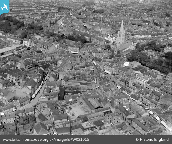
EPW021015 ENGLAND (1928). Chapel Street and St Andrew's Church, Rugby, 1928
© Copyright OpenStreetMap contributors and licensed by the OpenStreetMap Foundation. 2026. Cartography is licensed as CC BY-SA.
Nearby Images (9)
EPW021015

EPW010531

EPW001339

EPW001338

EPW021013

EPW033935

EPW005577

EPW012039

EPW021018

Details
| Title | [EPW021015] Chapel Street and St Andrew's Church, Rugby, 1928 |
| Reference | EPW021015 |
| Date | April-1928 |
| Link | |
| Place name | RUGBY |
| Parish | |
| District | |
| Country | ENGLAND |
| Easting / Northing | 450270, 275180 |
| Longitude / Latitude | -1.2615286940879, 52.37197375495 |
| National Grid Reference | SP503752 |
Pins

Ian Robinson |
Friday 25th of October 2013 06:52:19 PM | |
|
Ian Robinson |
Sunday 7th of October 2012 09:24:08 PM | |
|
Ian Robinson |
Monday 1st of October 2012 08:40:53 PM | |
|
Ian Robinson |
Monday 1st of October 2012 08:36:13 PM | |
|
Ian Robinson |
Sunday 23rd of September 2012 08:58:29 PM | |
|
Ian Robinson |
Sunday 23rd of September 2012 08:57:42 PM | |
|
Ian Robinson |
Sunday 23rd of September 2012 08:56:14 PM | |
|
Neville Taylor |
Sunday 23rd of September 2012 02:51:52 PM | |
|
Neville Taylor |
Sunday 23rd of September 2012 02:44:35 PM | |
|
Neville Taylor |
Sunday 23rd of September 2012 02:40:00 PM | |
|
Neville Taylor |
Sunday 23rd of September 2012 02:37:29 PM | |
|
Neville Taylor |
Sunday 23rd of September 2012 02:36:35 PM | |
|
Neville Taylor |
Sunday 23rd of September 2012 02:33:45 PM | |
|
Neville Taylor |
Sunday 23rd of September 2012 02:29:21 PM | |
|
Neville Taylor |
Sunday 23rd of September 2012 02:28:25 PM |