
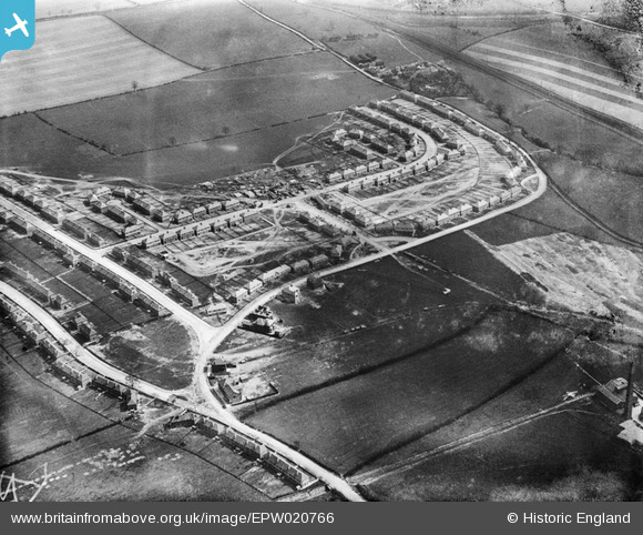
EPW020766 ENGLAND (1928). New housing under construction beside Upton Colliery, Upton, 1928
© Copyright OpenStreetMap contributors and licensed by the OpenStreetMap Foundation. 2025. Cartography is licensed as CC BY-SA.
Nearby Images (17)
EPW020766

EPW020765

EAW047472

EPW020763

EPW020761

EAW047473

EPW020764

EPW020762

EPW020760

EPW020767

EAW047469

EAW047474

EAW047468

EAW047470

EAW047475

EAW047471

EAW047476A

Details
| Title | [EPW020766] New housing under construction beside Upton Colliery, Upton, 1928 |
| Reference | EPW020766 |
| Date | 11-May-1928 |
| Link | |
| Place name | UPTON |
| Parish | NORTH ELMSALL |
| District | |
| Country | ENGLAND |
| Easting / Northing | 448681, 413504 |
| Longitude / Latitude | -1.2640265884764, 53.615581784522 |
| National Grid Reference | SE487135 |
Pins

Sue |
Tuesday 21st of April 2015 06:52:46 PM | |
|
Sue |
Tuesday 21st of April 2015 06:13:26 PM | |
|
MB |
Sunday 14th of October 2012 06:42:37 PM | |
|
MB |
Sunday 14th of October 2012 06:41:22 PM |