
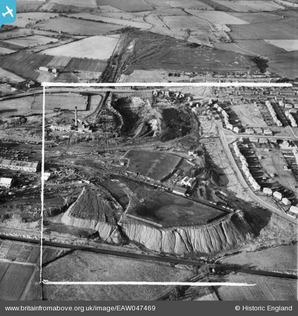
EAW047469 ENGLAND (1952). Upton Colliery, Upton, 1952. This image was marked by Aerofilms Ltd for photo editing.
© Copyright OpenStreetMap contributors and licensed by the OpenStreetMap Foundation. 2025. Cartography is licensed as CC BY-SA.
Nearby Images (16)
EAW047469

EAW047471

EAW047475

EAW047474

EAW047473

EAW047468

EAW047470

EAW047476A

EPW020763

EAW047472

EPW020766

EPW020767

EPW020765

EPW020761

EPW020760

EPW020762

Details
| Title | [EAW047469] Upton Colliery, Upton, 1952. This image was marked by Aerofilms Ltd for photo editing. |
| Reference | EAW047469 |
| Date | 10-October-1952 |
| Link | |
| Place name | UPTON |
| Parish | UPTON |
| District | |
| Country | ENGLAND |
| Easting / Northing | 448520, 413541 |
| Longitude / Latitude | -1.2664546480291, 53.615929302077 |
| National Grid Reference | SE485135 |
Pins

Sue |
Tuesday 21st of April 2015 07:47:53 PM | |
|
Sue |
Tuesday 21st of April 2015 07:45:44 PM |