
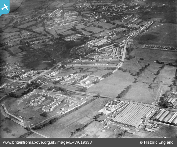
EPW019338 ENGLAND (1927). New housing next to the London Aerodrome, Burnt Oak, 1927
© Copyright OpenStreetMap contributors and licensed by the OpenStreetMap Foundation. 2026. Cartography is licensed as CC BY-SA.
Nearby Images (23)
EPW019338

EPW019337

EPW017380

EPW019336

EPW019314

EPW016518

EPW017582

EPW019315

EPW031550

EPW017586

EPW017379

EPW017580

EPW009682

EPW009346

EPW019335

EPW016517

EPW009344

EPW016519

EPW009363

EPW009345

EPW009347

EPW031549

EPW017587

Details
| Title | [EPW019338] New housing next to the London Aerodrome, Burnt Oak, 1927 |
| Reference | EPW019338 |
| Date | 23-September-1927 |
| Link | |
| Place name | BURNT OAK |
| Parish | |
| District | |
| Country | ENGLAND |
| Easting / Northing | 520493, 190508 |
| Longitude / Latitude | -0.26006908186875, 51.600036239883 |
| National Grid Reference | TQ205905 |
